
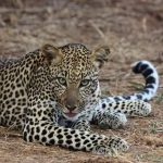
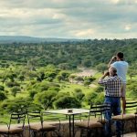
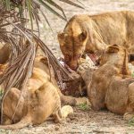
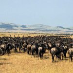
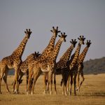
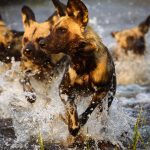
The Lemosho route is considered the most scenic trail on Kilimanjaro, granting panoramic vistas on various sides of the mountain. As one of the newer routes, Lemosho is a superb choice for your climb. It is our preferred route due to its ideal balance of low crowds, beautiful scenery and a high summit success rate. Most of the clients climb Kilimanjaro using lemosho route and their feedback on this route is excellent. We highly recommend the Lemosho route to our clients. The climb begins at Londorossi Gate at an altitude of 2360 meters, with an approach far to the west of the mountain. It then circles around Kilimanjaro to the south, passing through the majestic rainforest where some of the region’s most unique wildlife can often be seen. The route continues up to the mountain’s third summit at Shira Ridge.
Duration: 7 or 8 days
This 70km route will take most climbers at least 7 or 8 days to complete. It is considered by many as the most beautiful route up Kilimanjaro and has also become popular due to the low foot traffic, high summit success rate and incredible panoramic views. This route is highly recommended.
Itinerary
Kilimanjaro Airport – Usa River
You will be picked up at Kilimanjaro Airport in Tanzania by our transfer driver and taken to the Meru View Lodge in Usa River. The rest of the day will be free. Relax at the pool or explore the small town of Arusha. There will be a pre-departure briefing on what can be expected over the next days and a gear check at the hotel before tour start. You’ll dine at the lodge and get a necessary good night’s sleep.
Dinner
Up and away. You will drive to Lemosho Gate where you will be registered by the national park authorities. A moderately steep path leads to the Big Tree Camp (2780 m). Look out for monkeys and interesting birds along the way. The tents will be already set up and hot tea and washing water will be waiting.
Breakfast, Lunch, DinnerStart: Lemosho Gate (2385 m)
Finish: Big Tree Camp (2780 m)
Altitude: ↑ 395 m
Walking Time: 2-3h
Path follows through forest on a clear path with a moderate incline. You might see monkeys
Today’s long trek starts on a small trail which continues through the trees and gradually ascends to reach the Shira plateau. Enjoy the views of the mountain and plains below. The path continues to cross the Shira Ridge (ca. 3600 m) and you will stop for lunch at the Shira Camp 1 after another few hours. The last section (approximately 3 hrs), you will climb another 250 meters in altitude and pass the surreal Senecia-plants growing to over 8m in height. Reaching the camp after the long day, you will relax with coffee and tea and be nourished with a 3-course meal tonight. As the sun sets you might see the summit glowing in the afternoon sun.
Breakfast, Lunch, DinnerStart: Big Tree Camp (2780 m)
Finish: Shira Camp 2 (3900 m)
Altitude: ↑ 1120 m
Walking Time: 7-8h
A long day. Path is up and down until you ascent out of the rainforest section. Here you should have clear views of the Shira Ridge and the Kibo Summit on a sunny day.
You will gain 700m in altitude but descend to sleep at Barranco – 60 m higher than last night’s camp. This will help with acclimatisation as you will go up to 4600 m before descending again. Today begins with a long uphill in the direction of the Lava Tower Hut (4640m) and you will notice how the landscape changes to a rocky alpine desert. Later, the path descends again to the Barranco Valley with its giant Senecias and Lobelias. After six to seven hours you should arrive at the most beautiful camp on the mountain – the Barranco Camp.
Breakfast, Lunch, DinnerStart: Shira Camp 2 (3900 m)
Finish: Barranco Camp (3960 m)
Altitude: ↑740m ↓ 680 m
Walking Time: 6-7h
This day should help with acclimatisation as you will ‘walk high, sleep low’. A long trek through the shrubs of the heath and moorland zone to reach the Lava Tower rocks.
Today will start with the daunting Barranco Wall. Soon you will realize it looks worse than it actually is, but there are tricky sections where you will need to hold on tight. Admire the views from the top.
The rest of the route follows along the mountain ridge into the Karanga valley and out.
You reach Karanga Camp after lunch and you will have fantastic views of the southern glacier of Kibo as well as of the Kibo summit.
Breakfast, Lunch, DinnerStart: Barranco Camp (3960 m)
Finish: Karanga Camp (4035 m)
Altitude: ↑ 100 m ↓ 25 m
Walking Time: 3-4h
The imposing Barranco Wall lies ahead today, but it is not as bad as it looks. It is a steep climb but the views of Kibo’s southern glacier are breathtaking.
A few hours hiking through desolate and rocky moon-like landscape lies ahead. It will be a relatively easy day leading steadily uphill. The goal for today is the Barafu campsite on a narrow ridge in full view of Mawenzi peak. You will walk along a trail that passes through the afro-alpine dessert until you reach your destination for today –Barafu Camp at 4640 m. Use the rest of the day to relax and pack your daypack for tonight’s summit attempt. Supper will be served early; drink and eat enough if you can and try to sleep. You will be woken up around midnight to start your walk to the summit.
Breakfast, Lunch, DinnerStart: Karanga Camp (4035 m)
Finish: Barafu Camp (4640 m)
Altitude: ↑ 605 m
Walking Time: 3-4h
A relative easy day through a desolate moon landscape.
It is dark and cold as you set off just after midnight. You will climb the frozen volcanic dust by headlamp going towards Stella Point on the crater rim – about six hours. The sun should be rising when you arrive here. Just an hour or two more and you will be standing on the highest point of the crater: Uhuru peak. On top of the world! Take a short break for pictures and celebratory hugs before you tackle the steep and dusty descent. By now the volcanic ash will have thawed… You will stop for a short tea break at Barafu and then continue downhill for about three hours to Mweka camp (3080 m). This is your overnight stop. Refuel by drinking lots of fluids and have a good helping at supper time.
Breakfast, Lunch, DinnerStart: Barafu Camp (4640 m)
Finish: Uhuru Peak (5895 m) – Mweka Camp (3080 m)
Altitude: ↑ 1255 m ↓ 2815 m
Walking Time: 10-14h
Summit day starts off in the dark. You will first go to Stella Point on the crater’s rim. Another few hours to reach Uhuru peak in the early sunrise. You will ‘feel’ the altitude. After a few minutes at the summit, the descent is steep and long.
A traditional farewell ceremony from the porters begins the day. After about three hours of comfortably descending through the greenness of the forest, you should reach Mweka gate where the driver will be waiting. Back at the lodge, a hot shower, cold drinks, a debrief and your certificate of achievement are waiting. Well done!
Breakfast, Dinner Start: Mweka Camp (3080 m)
Finish: Mweka Gate (1630 m)
Altitude: ↓ 1450 m
Walking Time: 2-3h
Congratulations from the crew as they sing a traditional song and dance after breakfast. A relative short and easy descent through the green forest.
From 40 Reviews
Lorem ipsum dolor sit amet, consectetur adipiscing elit, sed do eiusmod tempor incididunt ut labore.


African Ratel Safari is a local safari and trekking company dedicated to providing unforgettable adventures in Tanzania. Our mission is to share the precious gifts of Tanzania’s nature with our guests and spread the wonderful spirit of our country around the world. Whether you choose to embark on expert-guided safaris and treks or seek refuge in our serene lodge in Arusha, immerse yourself in comfort and tranquility while exploring Tanzania’s breathtaking wilderness.
Join our community who receive emails filled with news, promotions, and other good stuff.
2024 African Ratel Safari. All rights reserved.
WhatsApp us


